Tour Dossier
This trip starts in the Tajik capital city Dushanbe but quickly leaves the modern world behind as you wind your way along difficult mountain roads and high passes, in the shadow of some of the highest mountains on our planet. We visit ruined forts from the days of the old Silk Road, and pass gem mines mentioned by Marco Polo. Spending many nights in homestays in small communities, we are able to gain a great insight into what it means to live in this harsh but majestic region. This trip ventures to a remote and enchanting land that has remained hidden to the rest of the world, a land of towering peaks, turbulent rivers and fascinating people. Traveling with us on one of the most amazing journeys you are ever likely to make.
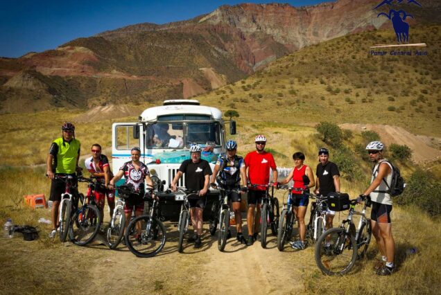
Tour style: Traveler (Adventure Travel)
Included/Excluded
- Overland transportation by 4WD coach (Land Cruiser / Toyota 4Runner for whole trip, ( parking fees, all necessary permissions fuel and taxes per the whole route)
- Experienced and basic English speaking driver for whole tour
- All accommodation on twin share basis as indicated above: (2 – Hotels, 5 – Guest houses, 1 – Home stays, 1 – Yurt stays).
- Full board meals as listed (11B – Breakfasts, 12L – Lunches, 11D – Dinners)
- Entrance fees for sites listed as part of the itinerary
- Ticket for Tajik national park
- 1/2L Mineral water per day per person
- Arrival and departure transfers,
- Supplement for single rooms per pax in USD 58
- Services of English speaking local guide for whole tour 518 USD
- International flights
- Any airport taxes
- Travel Insurance
- Alcohol drinks
Tour Plan
Meeting at your stayed hotel, and prepare luggage’s for our trip and get start our Adventure to Explore Tajikistan. We set off east towards the Pamirs and Kalaikhumb, driving through beautiful scenery and interesting villages en route. This area is a little more conservative, and we see many men with beards, and women wearing traditional dress. We cross the Shurabot Pass (2200 metres), arriving in Kalaikhumb in the early evening.
From Kalaikhumb we leave for Emts village in Bartang valley, some of 175 kms of terrain ahead of us, and the promise of some spectacular scenery along the way. The road joins the river Pianj, which in turn forms the border with Afghanistan. The contrast across the river valley is telling, Tajikistan is undoubtedly a poor country, but in general the roads are sealed and buildings are connected with electricity. The situation barely 100m away is even starker, and it is as if the river represents not just a physical divide, but also a step back in time.
Exploration the local people and environment. Next day we will drive to Gisev valley and cross Bartang River by footbridge. Although we should have some time to explore upon arrival, we will explore in more depth on. The trek begins on the river Bartang just beyond Bhagoo village and is mostly gently uphill, for about 8km to the upper of three lakes. The first houses in Geisev are reached after about 5km. The abundant vegetation, the gnarled trees, the lakes and the ever-changing river – sometimes frothing with energy, sometimes limpid and blue – create a very special peaceful atmosphere, ideal for a short break without too much physical effort. This route passing lakes and rivers traverses some of the most magnificent scenery in the Pamirs After the trekking drive to Khorog. 90 km 1,5 hour. Drive through more superb scenery, alongside the river Panj which forms the border with Afghanistan. We are in the capital of the Gorno-Badakshan Autonomous Oblast (GBAO). We have a little time to explore local people and Khorog including the bazaar and the lovely Botanical Gardens which are perched high above the town, affording some great panoramic views.
About 50kms along the road to our next stop, Ishkashim, we will stop at Garmchasma hot springs for an (optional) dip in the waters. From here, we enter the Tajik half of the Wakhan Valley (shared with Afghanistan) and pass regional gem mines mentioned by Marco Polo. The most famous mine is Koh-i-Lal ruby mine which is visible from the road. Ishkashim itself may be the regional centre, but it is essentially still a large village and we stay in a traditional style guesthouse here. Meals included: 1 breakfast, 1 Lunch, 1 dinner
Visit detour to the nearby village of Namadguti to visit the Khahkha Fortress. This impressive structure rises from a naturally formed platform of rock and dates back to the Kushan era of the 3rd Century. There are a number of these ancient fortresses in the area, and we also visit Yamchun fort, perhaps the most impressive of them. We take a break at the Bibi Fatima hot springs, named for the Prophet Mohammed’s sister and where local women believe they can increase their fertility. Continuing on we then stop at the 4th Century Buddhist stupas at Vrang, reminders of the ancient pilgrim caravans that passed through the region. You will have time to talk with local people and explore local farming and way of living
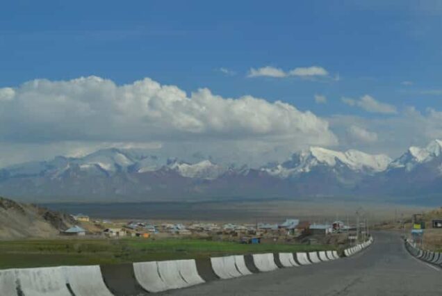
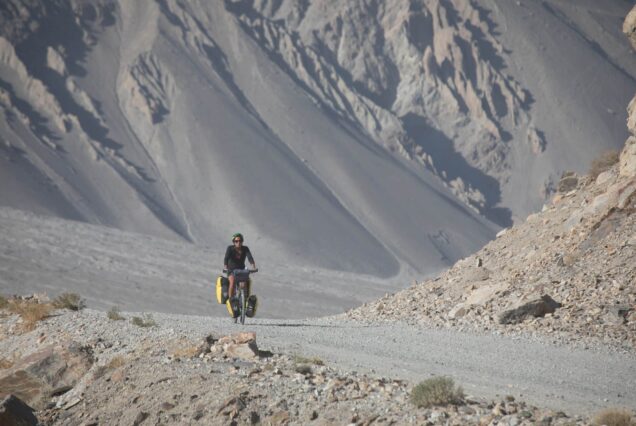
Today we get a chance to explore the amazing landscape of this area. Short stop and walking to Petroglyphs. We drive up to Keng Shiber via the Khargush Pass (4344 meters). On this journey we leave behind the lush valleys of the Wakhan Valley and enter a landscape that is rocky, mostly barren but nevertheless dramatic. This is the Pamir Highway we have anticipated, with the route between Khorog and Osh completed in 1931 across a Tibetan-plateau style high altitude terrain.
An excellent and adventures trip will take us on the unspoiled lunar landscape of high mountains and wide plateau to Keng Shiber herders camp. Short stops at the “Ak Balyk” Lake and Mouseleum of Alimbek datka at Bashgumbez en route. The Eastern Pamirs have been populated by nomadic ethnic Kyrgyz since the 17th century. The traditional architecture is beautifully represented by yurts, mobile habitations made of felt on an ingenious wooden frame, with the interior decoration bearing witness to the wealth and skills of the owners. Felt and wool serve as the basis for handicrafts. Precise stones, including rubies and emeralds, are also found in the area, and these are sometimes used in local handicrafts. You will have time to explore semi nomadic pastoral life, talk with herders’ family and take.
Overnight as nomads in herders’ yurt. Meals included: 1 breakfast, 1 Lunch, 1 dinner
Drive to Zorkul Lake after short walking near by the Lake an excellent and adventures trip is hike up the Bel Airyk pass (4835m) which is a migration route of Marco Polo sheep, starts from the foot of the mountain. Ascending up the pass in four/five hours walk you can see the majestic northern wall of Afghanistan Hindikush and fantastic Zor Kul Lake.
Along the western half of the Zorkul Lake runs Afghan – Tajik border. The lake’s eastern half lied in Tajikistan. In 1842, Lieutenant Woods of the British India Navy Explored the Pyanj and Pamir rivers as far as the latter’s source in Zorkul. Zorkul itself is 20 km long – the road runs along its northern shore.
Wildlife observation will be undertaken during the trek. The famous and endangered Marco Polo sheep (ovisammonpoli) world’s largest-horned argali sheep, Snow leopard endangered and fully protected species, ibexes, marmot and Brown bear, fox, hare are not full list of representatives of wild life of the area. From birds one can find the mountain goose (ular) pigeons, eagles, vulture, and etc.
Good eyes and a sporting scope or more powerful binoculars are essential tools and a field guide for wildlife viewing. These areas are all unique in their own way, and trips to these places are always fascinating.
however, is spectacular an, passing through again the settlement of Mamazair. This small town bestrides the Murghab River at an altitude of 3,650 m. Younghusband visited it in 1890 and wrote “It is a dreary, desolate spot… with a certain amount of grassy pasture and a few scrubby bushes by the river, but surrounded by barren hills, and bitterly cold. How these Russian soldiers can support existence there is a marvel…shut up in dreary quarters, with nothing whatever to do – week after week, month after month passing by in dull monotony….” Over a century later, nothing much has changed.
We anticipate arriving in Murghab in Lunch time. Murghab (3670 m) itself has few attractions, but it will serve as our base for a one night as we explore the area a little. The 7546 m – high Chinese peak of Mustag Ata is visible to the northeast of town, 110 km away in a direct line.
We depart today to Kara Kul lake.We will cross a high-altitude pass Ak-Baital Pass (4655 meters) which is the highest section of road in the former Soviet Union. Arrive to Karakul Lake, the highest lake in Central Asia, and at 3915 meters, too high to support any aquatic life. Today you can explore real Nomadic life of Eastern Pamir people, how to keep Yaks, and see milking the Yaks, also you will have opportunity to taste local Nomad foods, after exploring in late afternoon we depart back to Murghab 165kms drive.
Murghab (3670 m) itself has few attractions, but it will serve as our base for a one night as we explore the area a little. The 7546 m – high Chinese peak of Mustag Ata is visible to the northeast of town, 110 km away in a direct line.
We drive back to Khorog via M41. This is the famouse Pamir Highway we have anticipated, with the route between Khorog and Osh completed in 1931 across a Tibetan-plateau style high altitude terrain.
Today we set off in Kalaikhumb, driving back through beautiful scenery, The road joins the river Piano, which in turn forms the border with Afghanistan. The contrast across the river valley is telling, Tajikistan is undoubtedly a poor country, but in general the roads are sealed and buildings are connected with electricity. The situation barely 100m away is even starker, and it is as if the river represents not just a physical divide, but also a step back in time.
Today we set up to Dushanbe, driving through beautiful scenery and interesting villages en route.This area is a little more conservative, and we see many men with beards, and women wearing traditional dress.
Tour Map
Enquiry Form


Independent tour operator for adventure, culture, history, expeditions, and business consulting.
Quick Links
- © 2025 Silk Road Caravan All Rights Reserved.


Reviews
There are no reviews yet.